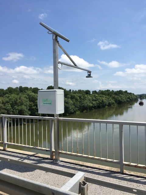
| Station name | CRNAC |
| Station ID | 3020 |
| Station type | Real time data aquisition |
| River | SAVA |
| Basin | BLACK SEA |
| District | Sava basin |
| Established | 16/01/1949 |
| End of operation | -- |
| Zero Datum (AMSL m) | 91,338 |
| Distance from the river mouth (km) | 575,000 |
| Distance from the river source (km) | -- |
| Catchment area (km2) | 22852,000 |
| Measurement type | Info |
| WATER LEVEL | Extremes periods: Years: 1949. - 1965. Zero datum: 90,030 AMSL Minimum: 16. 9. 1950. -55 cm Maximum: 30. 12. 1959. 904 cm Years: 1966. - 1986. Zero datum: 89,988 AMSL Minimum: 23. 11. 1986. -126 cm Maximum: 7. 10. 1974. 917 cm Years: 1987. - 2024. Zero datum: 91,338 AMSL Minimum: 19. 8. 2022. -246 cm Maximum: 26. 11. 1991. 798 cm Years in database: 1949-2024 |
| DISCHARGE | Extremes periods: Years: 1955. - 2024. Minimum: 19. 8. 2022. 64,50 m3/s Maximum: 26. 11. 1991. 2331 m3/s Years in database: 1955-1992 2001-2005 2007-2024 |
| TEMPERATURE | Extremes periods: Years: 1966. - 2024. Minimum: 2. 1. 1971. 0,0 °C Maximum: 27. 7. 2003. 29,0 °C Years in database: 1966-1967 1970-1992 1998-1999 2003-2024 |
| DISCHARGE MEASUREMENTS | Measurements: 347 |
| CROSS SECTIONS | Measurements: 5 |